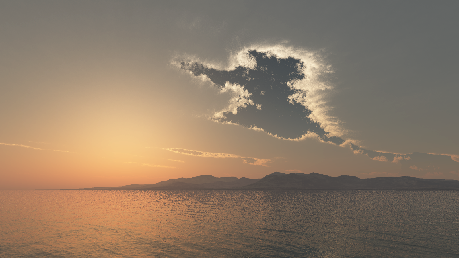
Ancient Lake Lahontan at Hawthorne, Nevada
Northern Nevada was once a high elevation, island archipelago.
In the centuries following Noah’s flood an ice age ensued. That ice age lasted hundreds of years. When the ice age began to recede, weather patterns changed and hundreds of lakes developed in the western United States. Paleo wind studies show that, Nevada regularly received moist air directly from the Gulf of Mexico. This moist air deposited a colossal amount of rain and snow which exceeded the evaporation rate, thus creating ponds and lakes. The lakes created by this weather pattern left behind sandy shorelines that we can still go see and touch today. This is an image of one of the largest lakes based upon geological studies of the shoreline evidence.
Surprisingly, the arid desert areas where Nevadan’s live and work today were once covered with water. A huge donut-shaped lake dominated northern Nevada. The lake is called Ancient Lake Lahontan. In this rendering I have restored the water level in relation to the surrounding terrain back to the highest level it had attained. You are seeing how Nevada likely looked thousands of years ago, in photographic quality!
Ancient Lake Lahontan at Hawthorne, Nevada
Ancient Lake Lahontan long ago submerged the area we know today as Hawthorne, Nevada and the Walker Lake Basin. The camera is high above the Garfield Hills also known as the Gillis Ranges in central Mineral County facing northwest. The location of the city of Hawthorne and the Hawthorne Army Ammunition Depot back then was submerged underneath this shallow lake. The Hawthorne area is relatively flat, so small changes in lake level will have large changes in shoreline boundary. Ancient Lake Lahontan is a pluvial lake (made from rain and runoff) with no outlet. This makes the lake water level subject to regular large fluctuations in shoreline from season to season. Considering this, I have imaged the southern portion of the lake as a marsh, with mud, efflorescence and grasses. This area marked the southern extent of Lake Lahontan, although additional pluvial lakes existed further south, none were known to become attached to greater Lake Lahontan. We know this lake today as Walker Lake. Walker Lake is one of three remaining remnants of the once great Ancient Lake Lahontan. The other two remnants are Pyramid Lake north of Reno, Nevada which is 139 miles away and Honey Lake near Susanville, California 208 miles away.
In 2016 I received a grant from the Nevada Arts Council. The grant was given for the purpose of creating a series of images of Ancient Lake Lahontan, of which this image is part.
Terrains in this scene have been replicated from Digital Elevation Maps made available by NASA Shuttle Radar Topography Mission (SRTM) flown aboard space shuttle Endeavour on February 11-22, 2000.
Digital Elevation Maps were made available by NASA and the U.S. Geological Survey.These data are distributed by the Land Processes Distributed Active Archive Center (LP DAAC), located at USGS/EROS, Sioux Falls, SD


