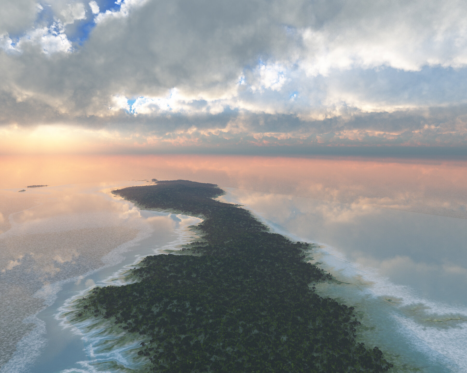
Ancient Lake Lahontan at Black Rock Desert, Nevada
Northern Nevada was once a high elevation, island archipelago.
In the centuries following Noah’s flood an ice age ensued. That ice age lasted hundreds of years. When the ice age began to recede, weather patterns changed and hundreds of lakes developed in the western United States. Paleo wind studies show that long ago, Nevada regularly received moist air directly from the Gulf of Mexico. This moist air deposited a colossal amount of rain and snow which exceeded the evaporation rate, thus creating ponds and lakes. The lakes created by this weather pattern left behind sandy shorelines that we can still go see and touch today. This is an image of one of the largest lakes based upon geological studies of the shoreline evidence.
Surprisingly, the arid desert areas where Nevadan’s live and work today were once covered with water. A huge donut-shaped lake dominated northern Nevada. The lake is called Ancient Lake Lahontan. In this rendering I have restored the water level in relation to the surrounding terrain back to the highest level it had attained. You are seeing how Nevada likely looked thousands of years ago, in photographic quality!
Ancient Lake Lahontan at Black Rock Desert, Nevada
Ancient Lake Lahontan from this perspective goes back over 150 miles stretching all the way to the edge of the Oregon border. This area includes some of the largest open expanses of water in the lake, being regularly 30 to 50 miles wide. The camera in this image is about 10,000 feet elevation, that makes the view about 100 miles. The present-day elevation of the valley floor would put the town of Gerlach, NV under approximately 420 feet of water during Lake Lahontan’s highest lake level.
The Black Rock Desert Playa is one of the largest, flattest surfaces on the earth covering about 200 square miles. It was here, back in 1997 Andy Green drove a vehicle called the Thrust SSC to a world record of 763 miles per hour. Also, the beautiful “Fly Geyser”, a geothermal spring is located inside the large bay on the left. Read more HERE.
The population sign for the Town of Gerlach, NV reads “Population – Wanted.” In reality, Gerlach is a small town of a couple hundred residents. Today, the area is home to the “Burning Man Festival.” The festival is held once a year and attracts tens of thousands of non-conforming, party-goer types. Often during Burning Man the winds will kick up. Party goers resort to gas masks as they find themselves immersed in a sea of dust from the ancient lake bottom.
In 2016 I received a grant from the Nevada Arts Council. The grant was given for the purpose of creating a series of images of Ancient Lake Lahontan, of which this image is part.
Terrains in this scene have been replicated from Digital Elevation Maps made available by NASA Shuttle Radar Topography Mission (SRTM) flown aboard space shuttle Endeavour on February 11-22, 2000.
Digital Elevation Maps were made available by NASA and the U.S. Geological Survey.These data are distributed by the Land Processes Distributed Active Archive Center (LP DAAC), located at USGS/EROS, Sioux Falls, SD


